
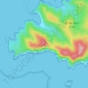
Mont Vinaigre topographic map
Interactive map
Click on the map to display elevation.
About this map
Name: Mont Vinaigre topographic map, elevation, terrain.
Average elevation: 118 ft
Minimum elevation: -10 ft
Maximum elevation: 630 ft
Other topographic maps
Click on a map to view its topography, its elevation and its terrain.
Île du Levant
France > Provence-Alpes-Côte d'Azur > Hyères
Île du Levant, Hyères, Toulon, Var, Provence-Alpes-Côte d'Azur, France métropolitaine, 83400, France
Average elevation: 46 ft