
Bruniquel topographic map
Interactive map
Click on the map to display elevation.
About this map
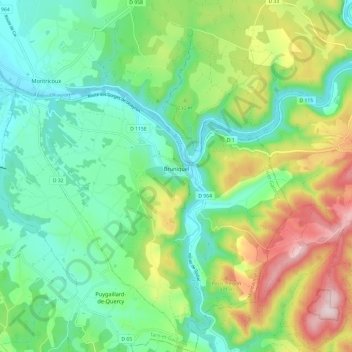
Name: Bruniquel topographic map, elevation, terrain.
Average elevation: 705 ft
Minimum elevation: 305 ft
Maximum elevation: 1,542 ft
Bruniquel ligt op een hoogte boven de Aveyron en bezit twee historische kastelen. Het oudste dateert uit de 13e eeuw en het jongste uit de 15e eeuw.