
Kampung Kurnia Jaya topographic map
Interactive map
Click on the map to display elevation.
About this map
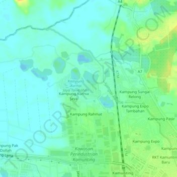
Name: Kampung Kurnia Jaya topographic map, elevation, terrain.
Location: Kampung Kurnia Jaya, Larut, Matang and Selama, Perak, Malaysia (4.89358 100.69148 4.93358 100.73148)
Average elevation: 30 ft
Minimum elevation: -10 ft
Maximum elevation: 92 ft