
Δήμος Μοσχάτου-Ταύρου topographic map
Interactive map
Click on the map to display elevation.
About this map
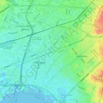
Name: Δήμος Μοσχάτου-Ταύρου topographic map, elevation, terrain.
Average elevation: 69 ft
Minimum elevation: -23 ft
Maximum elevation: 243 ft
Other topographic maps
Click on a map to view its topography, its elevation and its terrain.
Kallithea
Griechenland > Attika > Regionalbezirk Athen-Süd
Kallithea, Δήμος Καλλιθέας, Regionalbezirk Athen-Süd, Region Attika, Attika, 176 03, Griechenland
Average elevation: 171 ft