Geolocate

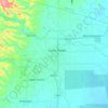
Kapalong topographic map

Click on the map to display elevation.

About this map
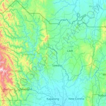
Name: Kapalong topographic map, elevation, terrain.

Location: Kapalong, Davao del Norte, Davao Region, 8113, Philippines (7.55165 125.37497 8.06460 125.71971)

Average elevation: 738 ft

Minimum elevation: 36 ft

Maximum elevation: 4,783 ft

Other topographic maps

Click on a map to view its topography, its elevation and its terrain.
Samal Island

Philippines > Davao del Norte > IGaCoS

Average elevation: 384 ft

Santo Tomas

Philippines > Davao del Norte

Average elevation: 151 ft

Tagum

Philippines > Davao del Norte > Tagum

One of the significant accomplishments of the officialdom of Tagum during the 1990s was its elevation from a second to the first-class municipality. This opened a gateway to increase its financial resources through the Internal Revenue Allocation (IRA) from the national government and local revenues. This was…

Average elevation: 338 ft
Panabo

Philippines > Davao del Norte > Panabo

Average elevation: 98 ft

Bandera

Philippines > Davao del Norte > Samal

Average elevation: 820 ft

Hijo River

Philippines > Davao del Norte > Apokon

Average elevation: 154 ft

Del Monte

Philippines > Davao del Norte > New Corella

Average elevation: 876 ft

Casig-Ang

Philippines > Davao del Norte > Santo Tomas

Average elevation: 43 ft

Gear up for your next adventure:

🛠️Outdoor Gear Repair Kit - Essential tools to fix gear on the trail
🌧️Backpack Rain Cover - Keep gear dry in wet weather
☀️Outdoor Sunscreen - High protection sunscreen for outdoor activities
🧦Hiking Socks - Comfortable socks to prevent blisters on long hikes
🗃️Trail First Aid Kit - Essential kit for outdoor injuries and emergencies

As an Amazon Associate, this site earns from qualifying purchases at no extra cost to you.