
Ravine à Malheur topographic map
Interactive map
Click on the map to display elevation.
About this map
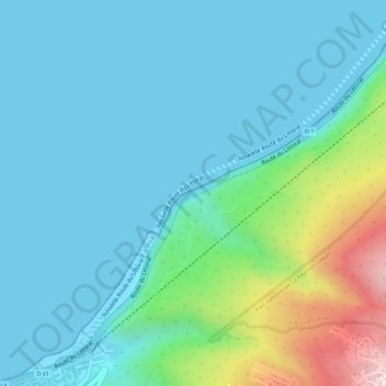
Name: Ravine à Malheur topographic map, elevation, terrain.
Average elevation: 285 ft
Minimum elevation: -7 ft
Maximum elevation: 1,421 ft
Other topographic maps
Click on a map to view its topography, its elevation and its terrain.
La Possession
France > La Réunion > La Possession > La Possession
La Possession, Saint-Paul, La Réunion, 97419, France
Average elevation: 463 ft
Prise des Galets
France > La Réunion > La Possession > Saint-Paul
Prise des Galets, Saint-Paul, La Possession, Saint-Paul, La Réunion, 97419, France
Average elevation: 2,398 ft