
Thank you for supporting this site ❤️
Make a donation
Make a donation
Gear up for your next adventure:
As an Amazon Associate, this site earns from qualifying purchases at no extra cost to you.
Pétange topographic map
Click on the map to display elevation.
Thank you for supporting this site ❤️
Make a donation
Make a donation
Gear up for your next adventure:
As an Amazon Associate, this site earns from qualifying purchases at no extra cost to you.
About this map
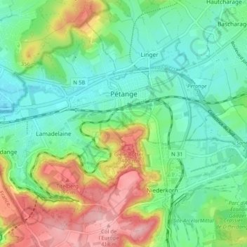
Name: Pétange topographic map, elevation, terrain.
Location: Pétange, Canton Esch-sur-Alzette, Luxembourg (49.52923 5.80813 49.57172 5.88743)
Average elevation: 1,040 ft
Minimum elevation: 863 ft
Maximum elevation: 1,385 ft
Thank you for supporting this site ❤️
Make a donation
Make a donation
Gear up for your next adventure:
As an Amazon Associate, this site earns from qualifying purchases at no extra cost to you.