
Thank you for supporting this site ❤️
Make a donation
Make a donation
Gear up for your next adventure:
As an Amazon Associate, this site earns from qualifying purchases at no extra cost to you.
Mandvi topographic map
Click on the map to display elevation.
Thank you for supporting this site ❤️
Make a donation
Make a donation
Gear up for your next adventure:
As an Amazon Associate, this site earns from qualifying purchases at no extra cost to you.
About this map
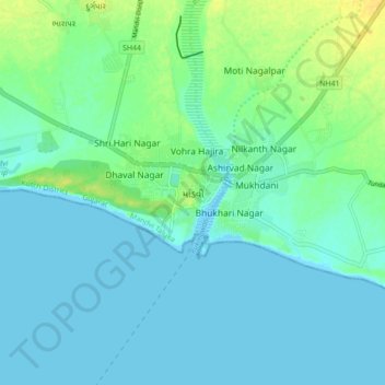
Name: Mandvi topographic map, elevation, terrain.
Location: Mandvi, Mandvi Taluka, Kachchh, Gujarat, 370405, India (22.79145 69.31081 22.87145 69.39081)
Average elevation: 20 ft
Minimum elevation: -3 ft
Maximum elevation: 75 ft
Thank you for supporting this site ❤️
Make a donation
Make a donation
Gear up for your next adventure:
As an Amazon Associate, this site earns from qualifying purchases at no extra cost to you.