
官屯镇 topographic map
Interactive map
Click on the map to display elevation.
About this map
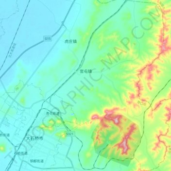
Name: 官屯镇 topographic map, elevation, terrain.
Location: 官屯镇, 大石桥市, 营口市, 辽宁省, 中国 (40.60708 122.52405 40.74946 122.66661)
Average elevation: 226 ft
Minimum elevation: 7 ft
Maximum elevation: 1,079 ft