
柳园镇 topographic map
Interactive map
Click on the map to display elevation.
About this map
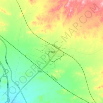
Name: 柳园镇 topographic map, elevation, terrain.
Location: 柳园镇, 瓜州县, 酒泉市, 甘肃省, 736100, 中国 (41.06398 95.45777 41.14398 95.53777)
Average elevation: 5,919 ft
Minimum elevation: 5,686 ft
Maximum elevation: 6,243 ft
柳园镇地势由东北向西南倾斜,平均海拔1797米,总面积9700平方公里,镇区面积8.9平方公里。年平均气温5.7℃,年最高气温37.5℃,年降水量83.7毫米,蒸发量为3140.6毫米,昼夜温差大,属典型的大陆性气候。
Other topographic maps
Click on a map to view its topography, its elevation and its terrain.