
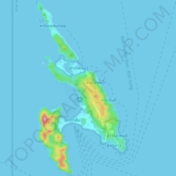
Ko Phi Phi Don topographic map
Interactive map
Click on the map to display elevation.
About this map
Name: Ko Phi Phi Don topographic map, elevation, terrain.
Location: Ko Phi Phi Don, Ao Nang, Krabi Province, Thailand (7.71735 98.75551 7.78749 98.79225)
Average elevation: 36 ft
Minimum elevation: 0 ft
Maximum elevation: 899 ft