
Bochum-Südwest topographic map
Interactive map
Click on the map to display elevation.
About this map
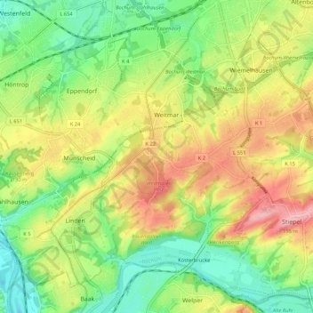
Name: Bochum-Südwest topographic map, elevation, terrain.
Location: Bochum-Südwest, Bochum, North Rhine-Westphalia, Germany (51.41348 7.11872 51.46799 7.22324)
Average elevation: 377 ft
Minimum elevation: 177 ft
Maximum elevation: 633 ft