
Mount Arrowsmith topographic map
Interactive map
Click on the map to display elevation.
About this map
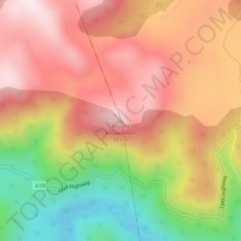
Name: Mount Arrowsmith topographic map, elevation, terrain.
Location: Mount Arrowsmith, Tasmania, Australia (-42.21053 146.07518 -42.21043 146.07528)
Average elevation: 2,497 ft
Minimum elevation: 1,506 ft
Maximum elevation: 3,222 ft
Other topographic maps
Click on a map to view its topography, its elevation and its terrain.
Ansons Bay
Ansons Bay, Break O'Day, Tasmania, 7264, Australia
Average elevation: 148 ft
Dove Lake
Australia > Tasmania > Cradle Mountain
Dove Lake, Cradle Mountain, Kentish, Tasmania, Australia
Average elevation: 3,478 ft
Glamorgan-Spring Bay
Glamorgan-Spring Bay, Tasmania, Australia
Average elevation: 659 ft