Geolocate

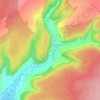
Nogent topographic map

Click on the map to display elevation.

About this map
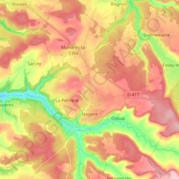
Name: Nogent topographic map, elevation, terrain.

Location: Nogent, Chaumont, Haute-Marne, Grand Est, Metropolitan France, 52800, France (47.99886 5.29534 48.08528 5.43186)

Average elevation: 1,309 ft

Minimum elevation: 974 ft

Maximum elevation: 1,562 ft

Other topographic maps

Click on a map to view its topography, its elevation and its terrain.
Château Orquevaux

France > Grand Est > Haute-Marne > Orquevaux

Average elevation: 1,188 ft

Langres

France > Grand Est > Haute-Marne > Langres > Langres

Average elevation: 1,296 ft

Les Ajots

France > Grand Est > Haute-Marne > Saint-Dizier

Average elevation: 505 ft

Montormentier

France > Grand Est > Haute-Marne > Cusey

Average elevation: 886 ft

Gear up for your next adventure:

🚗GPS Dash Cams - Record your scenic drives through mountain passes and canyons
🦺Reflective Outdoor Gear - Safety gear for low‑light conditions
☀️Outdoor Sunscreen - High protection sunscreen for outdoor activities
🥾Women's Hiking Boots - Top-rated trail boots with ankle support and superior grip
🥇GPS Hiking Watch - Multi‑sport GPS watch with navigation and trail tracking

As an Amazon Associate, this site earns from qualifying purchases at no extra cost to you.