
Timenguache topographic map
Interactive map
Click on the map to display elevation.
About this map
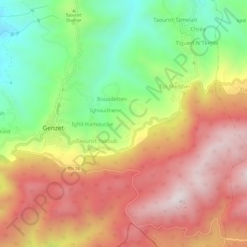
Name: Timenguache topographic map, elevation, terrain.
Location: Timenguache, Guenzet, Daïra Guenzet, Sétif, Algérie (36.29986 4.83123 36.33986 4.87123)
Average elevation: 3,629 ft
Minimum elevation: 2,218 ft
Maximum elevation: 4,970 ft
Other topographic maps
Click on a map to view its topography, its elevation and its terrain.
Ikhlidjen
Algérie > Sétif > Daïra Guenzet > Guenzet
Ikhlidjen, Guenzet, Daïra Guenzet, Sétif, Algérie
Average elevation: 2,697 ft
Ighil Lekhmis
Algérie > Sétif > Daïra Guenzet > Guenzet > Ighil Lekhmis
Ighil Lekhmis, Guenzet, Daïra Guenzet, Sétif, Algérie
Average elevation: 3,317 ft