
Paranhos da Beira topographic map
Interactive map
Click on the map to display elevation.
About this map
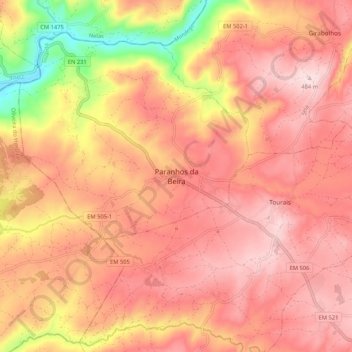
Name: Paranhos da Beira topographic map, elevation, terrain.
Location: Paranhos da Beira, Seia, Guarda, 6270-133, Portugal (40.43727 -7.82170 40.51727 -7.74170)
Average elevation: 1,243 ft
Minimum elevation: 551 ft
Maximum elevation: 1,588 ft
Other topographic maps
Click on a map to view its topography, its elevation and its terrain.
Serra da Estrela
Serra da Estrela, Seia, Guarda, Portugal
Average elevation: 5,988 ft