
Caneças topographic map
Interactive map
Click on the map to display elevation.
About this map
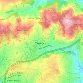
Name: Caneças topographic map, elevation, terrain.
Location: Caneças, Ramada e Caneças, Odivelas, Lisboa, Portugal (38.80262 -9.24112 38.83053 -9.20304)
Average elevation: 850 ft
Minimum elevation: 531 ft
Maximum elevation: 1,161 ft