
Singa topographic map
Interactive map
Click on the map to display elevation.
About this map
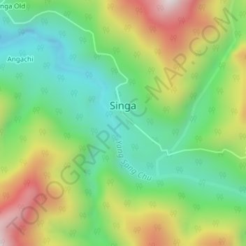
Name: Singa topographic map, elevation, terrain.
Location: Singa, Singa Circle, Upper Siang, Arunachal Pradesh, India (28.81396 95.18197 28.82297 95.19020)
Average elevation: 5,492 ft
Minimum elevation: 4,623 ft
Maximum elevation: 6,880 ft