
Heiligen Gestade topographic map
Interactive map
Click on the map to display elevation.
About this map
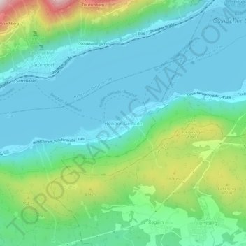
Name: Heiligen Gestade topographic map, elevation, terrain.
Location: Heiligen Gestade, Villach, Karinthië, 9495, Oostenrijk (46.63519 13.91916 46.67519 13.95916)
Average elevation: 2,159 ft
Minimum elevation: 1,634 ft
Maximum elevation: 3,881 ft