

Randfontein topographic map
Click on the map to display elevation.
Randfontein
As of 2011, Randfontein has a population of 149,286, which incorporates Mohlakeng and Toekomsrus. (In 2001, the population was 128,731.) The average elevation of the town is 1709m above sea level. The total municipal area, after recent restructuring, is 475 km2 (183 sq mi).
About this map
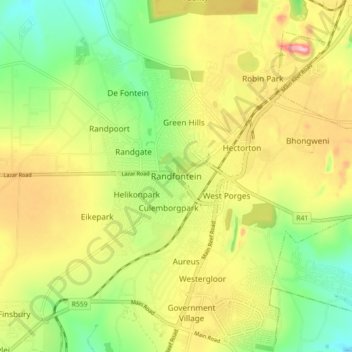
Name: Randfontein topographic map, elevation, terrain.
Average elevation: 5,581 ft
Minimum elevation: 5,295 ft
Maximum elevation: 5,928 ft
Other topographic maps
Click on a map to view its topography, its elevation and its terrain.

Randfontein Ward 1
South Africa > Gauteng > West Rand District Municipality > Randfontein Local Municipality
Average elevation: 5,236 ft