
Frampton topographic map
Interactive map
Click on the map to display elevation.
About this map
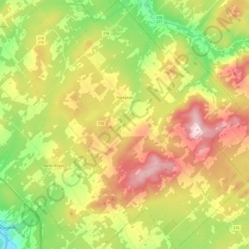
Name: Frampton topographic map, elevation, terrain.
Average elevation: 1,224 ft
Minimum elevation: 463 ft
Maximum elevation: 2,156 ft
Other topographic maps
Click on a map to view its topography, its elevation and its terrain.
Sainte-Marie
Canada > Quebec > La Nouvelle-Beauce
Sainte-Marie, La Nouvelle-Beauce, Chaudière-Appalaches, Quebec, Canada
Average elevation: 820 ft
Scott
Canada > Quebec > La Nouvelle-Beauce
Scott, La Nouvelle-Beauce, Chaudière-Appalaches, Quebec, Canada
Average elevation: 584 ft