
San Pedro topographic map
Interactive map
Click on the map to display elevation.
About this map
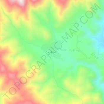
Name: San Pedro topographic map, elevation, terrain.
Location: San Pedro, Guanaceví, Durango, México (25.93683 -106.03927 25.97683 -105.99927)
Average elevation: 8,107 ft
Minimum elevation: 7,234 ft
Maximum elevation: 9,298 ft
Other topographic maps
Click on a map to view its topography, its elevation and its terrain.
La Rosilla
La Rosilla, Guanaceví, Durango, México
Average elevation: 6,804 ft