
Thank you for supporting this site ❤️
Make a donation
Make a donation
Gear up for your next adventure:
As an Amazon Associate, this site earns from qualifying purchases at no extra cost to you.
Huaca topographic map
Click on the map to display elevation.
Thank you for supporting this site ❤️
Make a donation
Make a donation
Gear up for your next adventure:
As an Amazon Associate, this site earns from qualifying purchases at no extra cost to you.
About this map
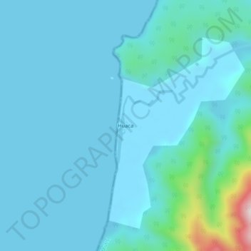
Name: Huaca topographic map, elevation, terrain.
Location: Huaca, Bahía Solano (Mutis), Pacífico Norte, Chocó, Colombia (6.30206 -77.39648 6.34206 -77.35648)
Average elevation: 154 ft
Minimum elevation: 0 ft
Maximum elevation: 1,562 ft
Thank you for supporting this site ❤️
Make a donation
Make a donation
Gear up for your next adventure:
As an Amazon Associate, this site earns from qualifying purchases at no extra cost to you.