
Oosteinde topographic map
Interactive map
Click on the map to display elevation.
About this map
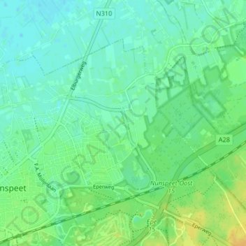
Name: Oosteinde topographic map, elevation, terrain.
Location: Oosteinde, Nunspeet, Gelderland, Nederland, 8072PD, Nederland (52.36910 5.79187 52.40910 5.83187)
Average elevation: 26 ft
Minimum elevation: -3 ft
Maximum elevation: 75 ft