
Joossesweg topographic map
Interactive map
Click on the map to display elevation.
About this map
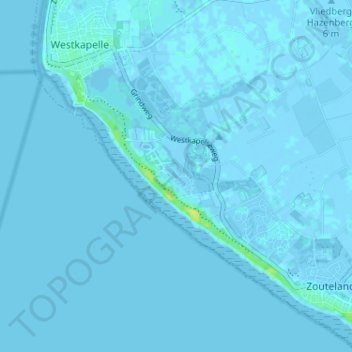
Name: Joossesweg topographic map, elevation, terrain.
Location: Joossesweg, Zeeland, Nederland, 4361KL, Nederland (51.49430 3.43844 51.53430 3.47844)
Average elevation: 0 ft
Minimum elevation: -13 ft
Maximum elevation: 49 ft