
Parque Nacional Natural Los Nevados topographic map
Interactive map
Click on the map to display elevation.
About this map
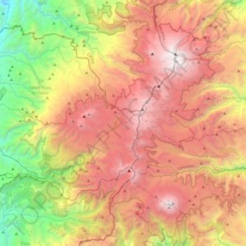
Name: Parque Nacional Natural Los Nevados topographic map, elevation, terrain.
Average elevation: 11,007 ft
Minimum elevation: 4,793 ft
Maximum elevation: 17,343 ft
At the end of the 19th century, six glaciers existed on the peaks of El Ruiz, Santa Isabel, Tolima, El Cisne, Quindío and the current Paramillo de Santa Rosa, and were located at an altitude of 4500 meters above sea level.