
Raceland topographic map
Click on the map to display elevation.
About this map
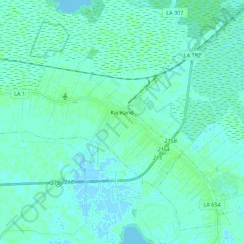
Name: Raceland topographic map, elevation, terrain.
Location: Raceland, Lafourche Parish, Louisiana, 70394, United States (29.68586 -90.71210 29.75818 -90.55891)
Average elevation: 7 ft
Minimum elevation: -7 ft
Maximum elevation: 20 ft
Lafourche Parish trails, hiking, mountain biking, running and outdoor activities
Other topographic maps
Click on a map to view its topography, its elevation and its terrain.