
Alibates Flint Quarries National Monument topographic map
Interactive map
Click on the map to display elevation.
About this map
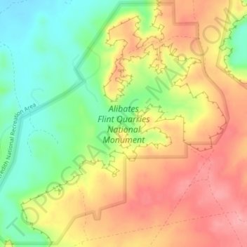
Name: Alibates Flint Quarries National Monument topographic map, elevation, terrain.
Average elevation: 3,107 ft
Minimum elevation: 2,920 ft
Maximum elevation: 3,274 ft
Other topographic maps
Click on a map to view its topography, its elevation and its terrain.
Amarillo
United States > Texas > Potter County
Amarillo, Potter County, Texas, United States
Average elevation: 3,599 ft
Amarillo
United States > Texas > Potter County
Amarillo, Potter County, Texas, United States
Average elevation: 3,599 ft
Bushland
United States > Texas > Potter County
Bushland, Potter County, Texas, 79012, United States
Average elevation: 3,825 ft
Amarillo
United States > Texas > Potter County > Amarillo
Amarillo, Potter County, Texas, 79105, United States
Average elevation: 3,576 ft