
Cabo Sardão topographic map
Interactive map
Click on the map to display elevation.
About this map
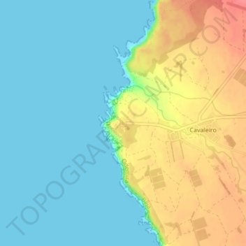
Name: Cabo Sardão topographic map, elevation, terrain.
Average elevation: 75 ft
Minimum elevation: -3 ft
Maximum elevation: 217 ft
Other topographic maps
Click on a map to view its topography, its elevation and its terrain.
Zambujeira do Mar
Portugal > Alentejo > São Teotónio
Zambujeira do Mar, São Teotónio, Odemira, Beja, Alentejo Litoral, Alentejo, 7630-777, Portugal
Average elevation: 203 ft