
Carlsbourg topographic map
Interactive map
Click on the map to display elevation.
About this map
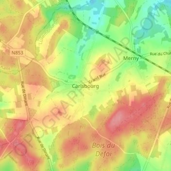
Name: Carlsbourg topographic map, elevation, terrain.
Location: Carlsbourg, Paliseul, Neufchâteau, Luxemburg, Wallonië, België (49.87476 5.06305 49.91476 5.10305)
Average elevation: 1,368 ft
Minimum elevation: 1,204 ft
Maximum elevation: 1,506 ft