
Felguera topographic map
Interactive map
Click on the map to display elevation.
About this map
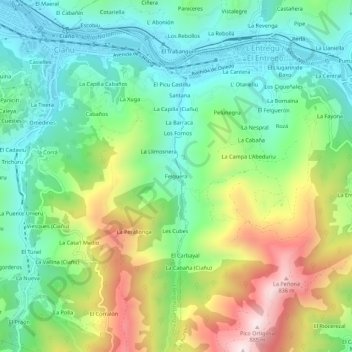
Name: Felguera topographic map, elevation, terrain.
Location: Felguera, Langreo, Asturias, 33940, España (43.25404 -5.67087 43.29404 -5.63087)
Average elevation: 1,430 ft
Minimum elevation: 696 ft
Maximum elevation: 2,831 ft
Other topographic maps
Click on a map to view its topography, its elevation and its terrain.