
Pajala kommun topographic map
Interactive map
Click on the map to display elevation.
About this map
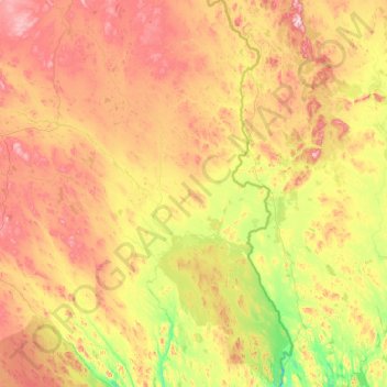
Name: Pajala kommun topographic map, elevation, terrain.
Location: Pajala kommun, Norrbotten County, Sweden (66.65847 21.84520 68.15421 23.88982)
Average elevation: 860 ft
Minimum elevation: 210 ft
Maximum elevation: 2,648 ft
Other topographic maps
Click on a map to view its topography, its elevation and its terrain.
Esrange Space Center
Sweden > Norrbotten County > Jukkasjärvi
Esrange Space Center, Jukkasjärvi, Kiruna kommun, Norrbotten County, Sweden
Average elevation: 1,089 ft
Luleå
Luleå, Luleå kommun, Norrbotten County, 971 28, Sweden
Average elevation: 36 ft
Kiruna kommun
Kiruna kommun, Norrbotten County, Sweden
Average elevation: 2,028 ft
Harju
Sweden > Norrbotten County > Harju
Harju, Haparanda kommun, Norrbotten County, 95393, Sweden
Average elevation: 112 ft
Jokkmokks kommun
Jokkmokks kommun, Norrbotten County, Sweden
Average elevation: 1,765 ft