
Puebla de Alcocer topographic map
Interactive map
Click on the map to display elevation.
About this map
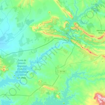
Name: Puebla de Alcocer topographic map, elevation, terrain.
Location: Puebla de Alcocer, Badajoz, Extremadura, 06630, España (38.96137 -5.41609 39.23686 -4.97431)
Average elevation: 1,355 ft
Minimum elevation: 981 ft
Maximum elevation: 3,077 ft
Other topographic maps
Click on a map to view its topography, its elevation and its terrain.
Llanos del Hospital
España > Extremadura > Puebla de Alcocer
Llanos del Hospital, Puebla de Alcocer, Badajoz, Extremadura, España
Average elevation: 1,266 ft