
孝义市 topographic map
Interactive map
Click on the map to display elevation.
About this map
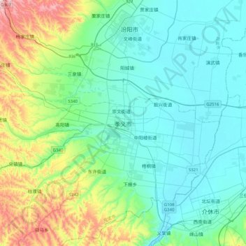
Name: 孝义市 topographic map, elevation, terrain.
Location: 孝义市, 新义街道, 孝义市, 吕梁市, 山西省, 中国 (36.98529 111.61248 37.30529 111.93248)
Average elevation: 2,779 ft
Minimum elevation: 2,379 ft
Maximum elevation: 4,304 ft
孝义市的位置介于东经111°21′-111°56′,北纬36°56′-37°18′之间,海拔731-1777米,总面积为945.8平方公里。