
永济 topographic map
Interactive map
Click on the map to display elevation.
About this map
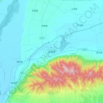
Name: 永济 topographic map, elevation, terrain.
Location: 永济, 城东街道, 永济市, 运城市, 山西省, 中国 (34.70612 110.28462 35.02612 110.60462)
Average elevation: 1,919 ft
Minimum elevation: 1,086 ft
Maximum elevation: 6,398 ft