
Westphalia topographic map
Interactive map
Click on the map to display elevation.
About this map
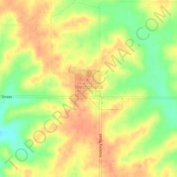
Name: Westphalia topographic map, elevation, terrain.
Location: Westphalia, Shelby County, Iowa, 51578, United States (41.71621 -95.39898 41.72270 -95.38808)
Average elevation: 1,401 ft
Minimum elevation: 1,306 ft
Maximum elevation: 1,460 ft
Other topographic maps
Click on a map to view its topography, its elevation and its terrain.
Harlan
United States > Iowa > Shelby County
Harlan, Shelby County, Iowa, United States
Average elevation: 1,247 ft
Kirkman
United States > Iowa > Shelby County
Kirkman, Shelby County, Iowa, United States
Average elevation: 1,270 ft
Kirkman
United States > Iowa > Shelby County > Kirkman > Kirkman
Kirkman, Shelby County, Iowa, 51446, United States
Average elevation: 1,289 ft
Defiance
United States > Iowa > Shelby County > Defiance
Defiance, Shelby County, Iowa, United States
Average elevation: 1,302 ft