
Saints-Geosmes topographic map
Interactive map
Click on the map to display elevation.
About this map
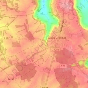
Name: Saints-Geosmes topographic map, elevation, terrain.
Average elevation: 1,470 ft
Minimum elevation: 1,217 ft
Maximum elevation: 1,568 ft
Other topographic maps
Click on a map to view its topography, its elevation and its terrain.
Fort de la Bonnelle
France > Grand Est > Haute-Marne > Saints-Geosmes
Fort de la Bonnelle, D 56, Saints-Geosmes, Langres, Haute-Marne, Grand Est, France métropolitaine, 52200, France
Average elevation: 1,457 ft