
Barrio Las Flores topographic map
Interactive map
Click on the map to display elevation.
About this map
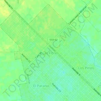
Name: Barrio Las Flores topographic map, elevation, terrain.
Average elevation: 56 ft
Minimum elevation: 23 ft
Maximum elevation: 82 ft
Other topographic maps
Click on a map to view its topography, its elevation and its terrain.
Los Patricios
Argentina > Buenos Aires > Miramar
Los Patricios, Miramar, Partido de General Alvarado, Buenos Aires, Argentina
Average elevation: 36 ft