
Pico Alto topographic map
Interactive map
Click on the map to display elevation.
About this map
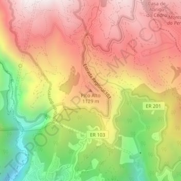
Name: Pico Alto topographic map, elevation, terrain.
Location: Pico Alto, Funchal, Madeira, 9050-401, Portugal (32.69281 -16.90283 32.69291 -16.90273)
Average elevation: 3,120 ft
Minimum elevation: 1,234 ft
Maximum elevation: 4,567 ft
Other topographic maps
Click on a map to view its topography, its elevation and its terrain.
Curral dos Romeiros
Curral dos Romeiros, Funchal, Madeira, 9050-401, Portugal
Average elevation: 2,136 ft