Geolocate

Kalkere topographic map

Click on the map to display elevation.

About this map

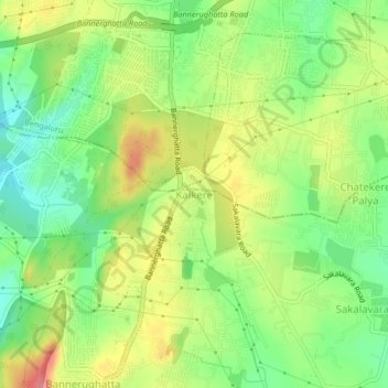
Name: Kalkere topographic map, elevation, terrain.

Location: Kalkere, Anekal, Bangalore Urban, Karnataka, 560108, India (12.81281 77.57069 12.85281 77.61069)

Average elevation: 3,045 ft

Minimum elevation: 2,894 ft

Maximum elevation: 3,235 ft

Gear up for your next adventure:

🪶Multi‑Purpose Knife - Useful blade for camp and trail
🪶Camp Gear Gift Set - Perfect gift bundle for outdoor fans
🪶Trail Camera - Capture wildlife on your hikes
🏕️Tent Footprint - Protect your tent base from wear
🥾Men's Hiking Boots - Durable, waterproof footwear for rugged terrain and steep inclines

As an Amazon Associate, this site earns from qualifying purchases at no extra cost to you.