
Thank you for supporting this site ❤️
Make a donation
Make a donation
Gear up for your next adventure:
As an Amazon Associate, this site earns from qualifying purchases at no extra cost to you.
Latrabjarg topographic map
Click on the map to display elevation.
Thank you for supporting this site ❤️
Make a donation
Make a donation
Gear up for your next adventure:
As an Amazon Associate, this site earns from qualifying purchases at no extra cost to you.
About this map
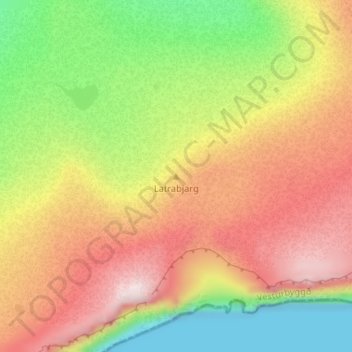
Name: Latrabjarg topographic map, elevation, terrain.
Location: Latrabjarg, Vesturbyggð, Iceland (65.50626 -24.41608 65.50636 -24.41598)
Average elevation: 722 ft
Minimum elevation: 0 ft
Maximum elevation: 1,444 ft
Thank you for supporting this site ❤️
Make a donation
Make a donation
Gear up for your next adventure:
As an Amazon Associate, this site earns from qualifying purchases at no extra cost to you.