
Estany de Baix de Baciver topographic map
Interactive map
Click on the map to display elevation.
About this map
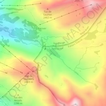
Name: Estany de Baix de Baciver topographic map, elevation, terrain.
Average elevation: 7,470 ft
Minimum elevation: 6,296 ft
Maximum elevation: 8,648 ft
Other topographic maps
Click on a map to view its topography, its elevation and its terrain.
Port de la Bonaigua
España > Cataluña > Pallars Sobirá > Alt Àneu
Port de la Bonaigua, Alt Àneu, Pallars Sobirá, Lérida, Cataluña, 25286, España
Average elevation: 6,841 ft