
Talarn topographic map
Interactive map
Click on the map to display elevation.
About this map
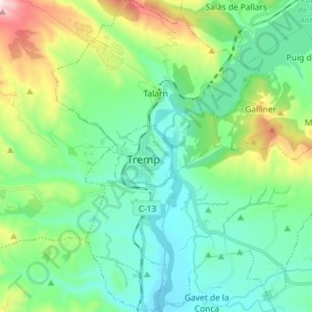
Name: Talarn topographic map, elevation, terrain.
Location: Talarn, Pallars Jussá, Lérida, Cataluña, 25630, España (42.12081 0.85753 42.21398 0.94217)
Average elevation: 1,867 ft
Minimum elevation: 1,263 ft
Maximum elevation: 3,717 ft