
Altenwerder topographic map
Interactive map
Click on the map to display elevation.
About this map
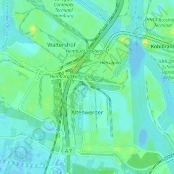
Name: Altenwerder topographic map, elevation, terrain.
Location: Altenwerder, Harburg, Hamburg, Germany (53.49845 9.87787 53.52221 9.94262)
Average elevation: 20 ft
Minimum elevation: -16 ft
Maximum elevation: 62 ft
Other topographic maps
Click on a map to view its topography, its elevation and its terrain.