
Monte Rotondo topographic map
Interactive map
Click on the map to display elevation.
About this map
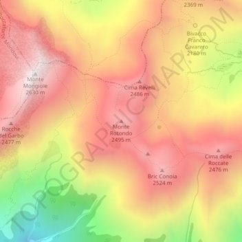
Name: Monte Rotondo topographic map, elevation, terrain.
Location: Monte Rotondo, Ormea, CN, Piemonte, Italia (44.16878 7.79858 44.16888 7.79868)
Average elevation: 7,208 ft
Minimum elevation: 5,020 ft
Maximum elevation: 8,586 ft
Other topographic maps
Click on a map to view its topography, its elevation and its terrain.
Rio Borgosozzo
Rio Borgosozzo, Case Pollaio, Ormea, Cuneo, Piemonte, Italia
Average elevation: 4,692 ft