
Conchita Chico topographic map
Interactive map
Click on the map to display elevation.
About this map
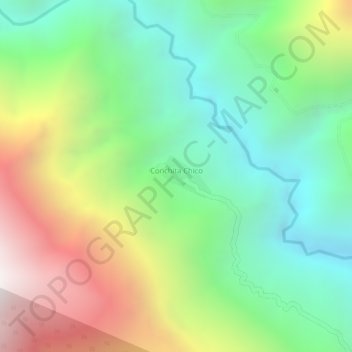
Name: Conchita Chico topographic map, elevation, terrain.
Average elevation: 5,597 ft
Minimum elevation: 3,776 ft
Maximum elevation: 8,304 ft
Other topographic maps
Click on a map to view its topography, its elevation and its terrain.
La Asunta
Bolivia > La Paz > Provincia Sud Yungas > Municipio La Asunta
La Asunta, Municipio La Asunta, Provincia Sud Yungas, La Paz, Bolivia
Average elevation: 2,838 ft