
Dive-le-Franc topographic map
Interactive map
Click on the map to display elevation.
About this map
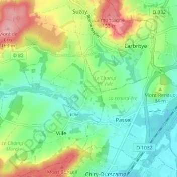
Name: Dive-le-Franc topographic map, elevation, terrain.
Average elevation: 253 ft
Minimum elevation: 105 ft
Maximum elevation: 531 ft
Other topographic maps
Click on a map to view its topography, its elevation and its terrain.
Les Usages
France > Hauts-de-France > Oise > Ville > Les Usages
Les Usages, Ville, Compiègne, Oise, Hauts-de-France, France métropolitaine, 60400, France
Average elevation: 272 ft