
La Madeleine topographic map
Interactive map
Click on the map to display elevation.
About this map
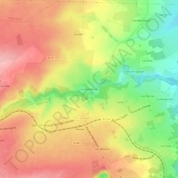
Name: La Madeleine topographic map, elevation, terrain.
Average elevation: 1,053 ft
Minimum elevation: 794 ft
Maximum elevation: 1,250 ft
Other topographic maps
Click on a map to view its topography, its elevation and its terrain.
La Croze
France > Auvergne-Rhône-Alpes > Allier > Huriel
La Croze, Huriel, Montluçon, Allier, Auvergne-Rhône-Alpes, France métropolitaine, 03380, France
Average elevation: 942 ft
Les Mélettes
France > Auvergne-Rhône-Alpes > Allier > Huriel
Les Mélettes, Huriel, Montluçon, Allier, Auvergne-Rhône-Alpes, France métropolitaine, 03380, France
Average elevation: 1,056 ft
Les Boueix
France > Auvergne-Rhône-Alpes > Allier > Huriel
Les Boueix, Huriel, Montluçon, Allier, Auvergne-Rhône-Alpes, France métropolitaine, 03380, France
Average elevation: 1,171 ft