
Seriana topographic map
Interactive map
Click on the map to display elevation.
About this map
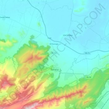
Name: Seriana topographic map, elevation, terrain.
Location: Seriana, Daïra de Seriana, Batna, Algérie (35.63277 6.08527 35.80110 6.30531)
Average elevation: 3,238 ft
Minimum elevation: 2,618 ft
Maximum elevation: 5,656 ft