
Baungon topographic map
Interactive map
Click on the map to display elevation.
About this map
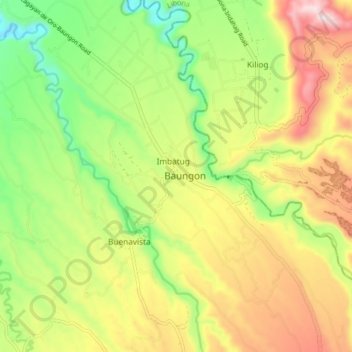
Name: Baungon topographic map, elevation, terrain.
Location: Baungon, Bukidnon, Northern Mindanao, 8707, Philippines (8.27237 124.64527 8.35237 124.72527)
Average elevation: 1,345 ft
Minimum elevation: 495 ft
Maximum elevation: 2,372 ft
Other topographic maps
Click on a map to view its topography, its elevation and its terrain.
Langaon
Philippines > Bukidnon > Baungon
Langaon, Baungon, Bukidnon, Northern Mindanao, Philippines
Average elevation: 741 ft